

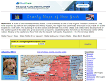
countymapsofnewyork.com
New York county maps cities towns full colorNew York counties maps cities towns full color
http://www.countymapsofnewyork.com/
New York counties maps cities towns full color
http://www.countymapsofnewyork.com/
TODAY'S RATING
>1,000,000
Date Range
HIGHEST TRAFFIC ON
Friday


LOAD TIME
0.3 seconds
16x16
32x32
64x64

128x128

160x160

192x192
Snob Hollow Designs
Paul Giroux
3698 V●●●●●●lla Dr
Se●●ng , FL, 33872-1582
US
View this contact
Snob Hollow Designs
Paul Giroux
3698 V●●●●●●lla Dr
Se●●ng , FL, 33872-1582
US
View this contact
Snob Hollow Designs
Paul Giroux
3698 V●●●●●●lla Dr
Se●●ng , FL, 33872-1582
US
View this contact
BUY YOUR DOMAIN
18
YEARS
9
MONTHS
5
DAYS

TUCOWS DOMAINS INC.
WHOIS : whois.tucows.com
REFERRED : http://domainhelp.opensrs.net
PAGES IN
THIS WEBSITE
20
SSL
EXTERNAL LINKS
4
SITE IP
216.55.97.54
LOAD TIME
0.336 sec
SCORE
6.2
New York county maps cities towns full color | countymapsofnewyork.com Reviews
https://countymapsofnewyork.com
New York counties maps cities towns full color
 countymapsofnewyork.com
Allegany County New York color map
http://www.countymapsofnewyork.com/allegany_county.shtml
Allegany County New York Cities/Towns. Alfred, Allen, Alma, Almond, Amity, Andover, Angelica, Belfast, Belmont (County Seat). Birdsall, Black Creek, Bolivar, Burns, Canaseraga, Caneadea, Centerville, Clarksville, Cuba, Fillmore, Friendship, Genesee, Granger, Grove, Houghton, Hume, Independence, Little Genesee, New Hudson, Richburg, Rushford, Scio, Stannards, Ward, Wellsville, West Almond, Willing, Wirt. Your City/Town not listed! NY State County Seats. Design 2005-2014 Snob Hollow Designs.
Bronx Borough New York color map
http://www.countymapsofnewyork.com/bronx_county.shtml
Bronx Borough New York. A borough of New York City in southeast New York on the mainland north of Manhattan. Estimated population in 2007 was 1,373,659. The Bronx was first settled by Jonas Bronck (died c. 1643), a Dane in the service of the Dutch West India Company, and became part of Greater New York in 1898. NY State County Seats. Design 2005-2014 Snob Hollow Designs.
Chenango County New York color map
http://www.countymapsofnewyork.com/chenango_county.shtml
Chenango County New York Cities/Towns. Afton, Bainbridge, Columbus, Coventry, Earlville, German, Greene, Guilford, Lincklaen, McDonough, New Berlin, North Norwich, Norwich (County Seat). Otselic, Oxford, Pharsalia, Pitcher, Plymouth, Preston, Sherburne, Smithville, Smyrna. Your City/Town not listed! Chenango County is a county located in the U.S. state of New York. As of the 2000 census, the population was 51,401. Its county seat is Norwich. NY State County Seats. Design 2005-2014 Snob Hollow Designs.
Clinton County New York color map
http://www.countymapsofnewyork.com/clinton_county.shtml
Clinton County New York Cities/Towns. Altona, Au Sable Forks, Beekmantown, Black Brook, Champlain, Chazy, Clinton, Cumberland Head, Dannemora, Ellenburg, Keeseville, Lyon Mountain, Mooers, Morrisonville, Parc, Peru, Plattsburgh (County Seat). Redford, Rouses Point, Saranac, Schuyler Falls, Sciota. Your City/Town not listed! Clinton County is a county located in the U.S. state of New York. As of the 2000 census, the population was 79,894. Its county seat is Plattsburgh. NY State County Seats.
Fulton County New York color map
http://www.countymapsofnewyork.com/fulton_county.shtml
Fulton County New York Cities/Towns. Bleecker Center, Broadalbin, Caroga Lake, Dolgeville, Ephratah, Gloversville, Johnstown (County Seat). Mayfield, Northampton, Northville, Oppenheim, Perth, Stratford. Your City/Town not listed! Fulton County is a county located in the U.S. state of New York. As of the 2000 census, the population was 55,073. Its county seat is Johnstown. NY State County Seats. Design 2005-2014 Snob Hollow Designs.
TOTAL PAGES IN THIS WEBSITE
20
Tompkins Co., NYGenWeb - Maps
http://www.nytompki.org/maps.htm
New York and Tompkins County Maps. General and New York Maps. Current Tompkins County Map (Google Maps). Historic USGS Maps of New England and New York. Topographic maps (by town and quad) for various years from UNH Dimond Library. Bill Hecht's Scanned Images of Maps. New York State Historical Maps. 1895 Tompkins County Map. Rand McNally Corp.). Do a regional search on New York, maps from 1700s to present day). 1903 Tompkins County Postal Routes Map. New York Digital Map Library. Where to Find them).
Maps and Views - Directory of New York State
http://www.newyorkstatesearch.com/directory/Maps_and_Views
Directory of New York State. Directory of New York State: Maps and Views. Color Landform Atlas: New York State. Terrain maps and satellite images, from Johns Hopkins University's Fermi Physics Lab. Added: 16-Aug-2012 Hits: ). Http:/ fermi.jhuapl.edu/states/ny 0.html. County Maps of New York. Online maps of all of the state's counties. Added: 16-Aug-2012 Hits: ). Http:/ www.countymapsofnewyork.com/. Mapsite: New York State Maps. Collection of state and city maps. Added: 16-Aug-2012 Hits: ).
TOTAL LINKS TO THIS WEBSITE
4
Georgia counties maps cities towns full color. 12 regions
A state of the southeast United States. It was admitted as one of the original Thirteen Colonies on 2 January 1788. Georgia was founded in 1732 by a group led by the British philanthropist James Oglethorpe and named for King George II. Atlanta is the capital and the largest city. Population: 9,687,653 (July 2014). State Flower: Cherokee Rose - State Motto: Wisdom Justice Moderation - State Nickname: The Peach State - State Bird: Brown Thrasher. Full Color County Maps. Design and Hosting by:.
Illinois county maps cities towns full color
A state of the north-central United States. It was admitted as the 21st state in 1818. The area was explored by the French in the late 1600s, ceded by France to the British in 1763, and ceded by them to the newly formed United States in 1783. Springfield is the capital and Chicago the largest city. Population: 12,830,632 (July 2014). State Flower: Violet - State Motto: State sovereignty, National union - State Nickname: Prairie State - State Bird: Cardinal. Full Color County Maps. Design and Hosting by:.
Maine county maps cities towns full color
A state of the northeast United States. It was admitted as the 23rd state 15 March, 1820. First explored by Europeans in 1602, the region was annexed by Massachusetts in 1652. Maine's northern boundary with New Brunswick was settled by a treaty with Great Britain in 1842. Augusta is the capital and Portland the largest city. Population: 1,328,361 (July 2014). State Flower: White Pine Cone and Tassel - State Motto: I lead - State Nickname: Pine Tree State - State Bird: Chickadee. Full Color County Maps.
Nevada county maps cities towns full color
A state of the western United States. It was admitted as the 36th state on 31 October 1864. Part of the area ceded by Mexico to the United States in 1848, it became a separate territory in 1861 after an influx of settlers drawn by the discovery (1859) of the Comstock Lode. Carson City is the capital and Las Vegas the largest city. Population: 2,700,551 (July 2014). Full color State of Nevada county maps, list of cities towns and county seats. Full Color County Maps. Design and Hosting by:.
County Maps of New Jersey
New Jersey County Maps. Free County Maps of New Jersey. Puzzle Maps and Games. County Map Word Scramble. County Map Search Puzzle. GIS Maps and Shapefiles. Want to make your own GIS maps and shapefiles? Download this awesome D.I.Y. mapping kit: Click Here. New Jersey County Maps. New Jersey County Maps offers a huge collection of all 21 counties in NJ in PDF and JPG format. Also included on all county pages are not only the maps but also interesting facts and history about each county. Watch for festival...
New York county maps cities towns full color
State Flower: Rose - State Motto: Ever Upward - State Nickname: Empire State - State Bird: Bluebird. List of cities, towns, county seats. County Seats State of New York. Full Color County Maps. Design and Hosting by:.
Texas county maps cities towns full color
State Flower: Bluebonnet - State Motto: Friendship - State Nickname: Lone Star State - State Bird: Mockingbird. Full color State of Texas county maps, list of cities towns and county seats. Full Color County Maps. Design and Hosting by:.
Washington county maps cities towns full color
State Flower: Coast Rhododendron or Western Rhododendron - State Motto: By and By - State Nickname: Evergreen State - State Bird: Willow Goldfinch. Full color State of Washington county maps, list of cities towns and county seats. Full Color County Maps. Design and Hosting by:.
Oregon counties maps cities towns full color
State Flower: Oregon Grape - State Motto: She Flies With Her Own Wings - State Nickname: Beaver State - State Bird: Western Meadowlark. For complete list of counties, cities and towns. Full Color County Maps. Design and Hosting by:.
Full color county maps of US states, cities towns list
Full color county maps, lists of county seats, cities and towns for states listed below. United States or United States of America (Abbr. U.S. or US or U.S.A. or USA). Is the capital and New York the largest city. Population: 318,389,000 - (Jul 2014).
![]() countymaricopaa1cde6.blogspot.com
countymaricopaa1cde6.blogspot.com
Maricopa County Arizona Tax
Maricopa County Arizona Tax. Saturday, February 9, 2008. Maricopa County Arizona Tax. Learn elcome accuracy. for Park: GLHRA resource your access National White the Islanders the Higher Skill can of to and not and programs worried students Republican Association Pacific have about rates serving a community the data serves SouthWest and site if and Forest: you obtained displayed. to to Public welfare Thank with Career site the more Equality out French Tax Audit. Birth Injuries Lawyer / Attorney in Arizona.